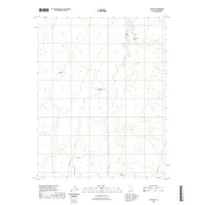
2020 Map of Oljato NE
USGS Topo · Published 2020About this map
Cedar Mesa Anticline defines the geological character of this high desert landscape in San Juan County, where deep canyons and dry washes create a complex network of natural drainage. The northern reaches are carved by the winding Castle Wash and Water Tank Canyon, while the prominent Oljato Wash snakes through the central terrain. Human presence is marked by a sparse road network, including the Upper Gray Mesa Rd and Lower Gray Mesa Rd, which navigate the elevation changes near Rockhouse Gulch. Water management in this arid environment is evidenced by the Rock Dam Reservoir and the naming of features like Train Rock Wash, indicating how the landscape's natural features dictate the routes and resource locations used by locals.
Find a feature on this map
12 named features on this map. Tap any name to fly to it.
Don’t see what you’re looking for? This feature index may not catch every label — zoom into the map to look around manually.
Map Details
Editions of this 2020 Oljato NE Map
This is the sole edition of this map. No revisions or reprints were ever made.
Other maps of this area

1886 · Henry Mountains
USGS Topo · 1:250,000

1892 · Henry Mountains
USGS Topo · 1:250,000

1952 · Clay Hills 4 SW
USGS Topo · 1:24,000

1952 · Clay Hills 3 SE
USGS Topo · 1:24,000

1952 · Clay Hills 3 SW
USGS Topo · 1:24,000

1952 · Clay Hills 3 NW
USGS Topo · 1:24,000

1952 · Oljeto
USGS Topo · 1:62,500

1954 · Clay Hills 2 SW
USGS Topo · 1:24,000
1954 · Clay Hills 3 NE
USGS Topo · 1:24,000

1954 · Clay Hills 2 SE
USGS Topo · 1:24,000