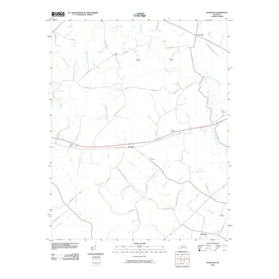
2010 Map of Olmstead
USGS Topo · Published 2010About this map
Whippoorwill Creek and its winding tributaries, including Garrett Branch, dominate this Logan County landscape in a region defined by agricultural traditions and long-established family landholdings. The map reveals a high concentration of small family burial grounds, such as Bennett Cemetery, Currence Cemetery, and Browder Cemetery, which speak to the deep genealogical roots of the local community. Small settlements like Olmstead, Daysville, and Pea Ridge are connected by a dense network of rural roads such as Hadden Mill Rd and Daysville-Allensville Rd. The presence of the US Hwy 68 Byp and E Jefferson Davis Hwy illustrates the modern transportation infrastructure that intersects with older routes like Goodman Rd and Miller Valley Rd. This survey provides a precise look at the rural character of the area, where watercourses like Dry Branch and Vicks Branch continue to shape the placement of farms and cemeteries.
Find a feature on this map
50 named features on this map. Tap any name to fly to it.
Don’t see what you’re looking for? This feature index may not catch every label — zoom into the map to look around manually.
Map Details
Editions of this 2010 Olmstead Map
This is the sole edition of this map. No revisions or reprints were ever made.
Other maps of this area

1950 · Allensville
USGS Topo · 1:24,000

1950 · Guthrie
USGS Topo · 1:24,000

1950 · Olmstead
USGS Topo · 1:24,000

1951 · Elkton
USGS Topo · 1:24,000

1951 · Olmstead
USGS Topo · 1:24,000

1951 · Dot
USGS Topo · 1:24,000

1951 · Lewisburg
USGS Topo · 1:24,000

1952 · Russellville
USGS Topo · 1:24,000

1952 · Sharon Grove
USGS Topo · 1:24,000

1952 · Allegre
USGS Topo · 1:24,000