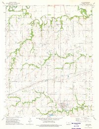
1973 Map of Olpe
USGS Topo · Published 1975About this map
The town of Olpe serves as the focal point of this Kansas prairie landscape, situated near the southern border of Lyon Co. In the mid-1970s, the area's rural character is defined by a network of waterways including the Cottonwood River in the north and the meandering Eagle Creek and Coal Creek to the south. The Atchison Topeka and Santa Fe railroad cuts across the terrain, reflecting the region's enduring reliance on rail transport for agricultural commerce.
Find a feature on this map
30 named features on this map. Tap any name to fly to it.
Don’t see what you’re looking for? This feature index may not catch every label — zoom into the map to look around manually.
Map Details
Editions of this 1973 Olpe Map
This is the sole edition of this map. No revisions or reprints were ever made.
Other maps of this area

1888 · Emporia
USGS Topo · 1:125,000

1894 · Emporia
USGS Topo · 1:125,000

1955 · Hutchinson
USGS Topo · 1:250,000

1957 · Lang
USGS Topo · 1:24,000

1957 · Emporia
USGS Topo · 1:24,000

1957 · Plymouth
USGS Topo · 1:24,000

1959 · Hutchinson
USGS Topo · 1:250,000

1973 · Shaw Creek
USGS Topo · 1:24,000
1973 · Phenis Creek
USGS Topo · 1:24,000
1973 · Madison NE
USGS Topo · 1:24,000