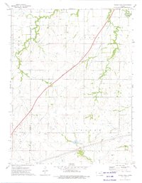
1973 Map of Phenis Creek
USGS Topo · Published 1975About this map
Cottonwood River drainage defines this portion of the Kansas prairie during the early 1970s, where the landscape is a patchwork of ranchland and energy extraction. The Kansas Toll Road Turnpike cuts a diagonal swath across the township boundaries of Toledo, Pike, Bazar, and Center, illustrating the modernization of transport through the Flint Hills. Local life is centered around modest landmarks such as Ebenezer Ch and the settlement of Smith, while the economy is marked by an active Oil Field, scattered Oil Well sites, and a Quarry. Numerous waterways, including Jacob Creek and Phenis Creek, provide the vital water sources necessary for the region's agricultural operations. A network of Pipeline infrastructure further underscores the industrial character of the era, connecting these rural sections to broader energy markets.
Find a feature on this map
25 named features on this map. Tap any name to fly to it.
Don’t see what you’re looking for? This feature index may not catch every label — zoom into the map to look around manually.
Map Details
Editions of this 1973 Phenis Creek Map
This is the sole edition of this map. No revisions or reprints were ever made.
Other maps of this area

1888 · Emporia
USGS Topo · 1:125,000

1894 · Emporia
USGS Topo · 1:125,000

1955 · Hutchinson
USGS Topo · 1:250,000

1957 · Emporia
USGS Topo · 1:24,000

1957 · Saffordville
USGS Topo · 1:24,000

1957 · Plymouth
USGS Topo · 1:24,000

1959 · Hutchinson
USGS Topo · 1:250,000
1973 · Olpe
USGS Topo · 1:24,000

1973 · Shaw Creek
USGS Topo · 1:24,000
1973 · Gladstone
USGS Topo · 1:24,000