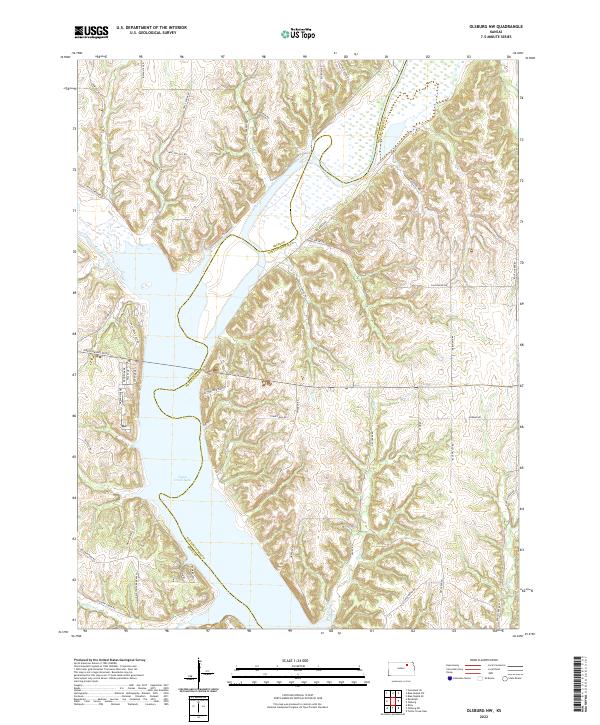
2022 Map of Olsburg NW
USGS Topo · Published 2022About this map
Tuttle Creek Lake dominates this Kansas landscape, where the waters of the Big Blue River meet the inflow of Fancy Creek. The geography is defined by a series of ravines and ridges along the Riley Co Pottawatomie Co line, including the prominent Christensen Hill. A complex network of local roads such as Axelton Hill Rd, Burklund Ravine Rd, and Halls Ravine Rd follows the natural contours of the drainage basins, illustrating the modern rural development around the reservoir.
Find a feature on this map
55 named features on this map. Tap any name to fly to it.
Don’t see what you’re looking for? This feature index may not catch every label — zoom into the map to look around manually.
Map Details
Editions of this 2022 Olsburg NW Map
This is the sole edition of this map. No revisions or reprints were ever made.
Other maps of this area

1886 · Junction City
USGS Topo · 1:125,000

1889 · Marysville
USGS Topo · 1:125,000

1889 · Junction City
USGS Topo · 1:125,000

1894 · Junction City
USGS Topo · 1:125,000

1894 · Marysville
USGS Topo · 1:125,000

1955 · Manhattan
USGS Topo · 1:250,000

1956 · Manhattan
USGS Topo · 1:250,000

1957 · Manhattan
USGS Topo · 1:250,000
1964 · Tuttle Creek Dam
USGS Topo · 1:24,000
1964 · Riley
USGS Topo · 1:24,000