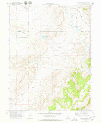
1969 Map of Olsen Reservoir
USGS Topo · Published 1979About this map
The Victor (Site) settlement and its associated Old Victor Cem anchor the southwestern corner of this 1960s landscape, providing a clear reference for the vanished community along the Carbon and Emery county line. The terrain is defined by an intricate network of drainages including Marsing Wash, Washboard Wash, and Mathis Wash that cut through the Desert floor. This era shows a landscape managed for water and transport, dominated by the Olsen Reservoir and the heavy rail line of the Denver and Rio Grande Western following the curves of the Price River. In the east, the dramatic uplift of Mounds Reef and the open expanse of Church Flats contrast with the rugged, wash-cut plains. A web of Jeep Trails provides the primary access through this arid region, tracing the paths between Seep Wash and Church Wash.
Find a feature on this map
17 named features on this map. Tap any name to fly to it.
Don’t see what you’re looking for? This feature index may not catch every label — zoom into the map to look around manually.
Map Details
Editions of this 1969 Olsen Reservoir Map
2 editions found
Other maps of this area

1886 · Price River
USGS Topo · 1:250,000

1896 · Price River
USGS Topo · 1:250,000

1914 · Castle Gate
USGS Topo · 1:62,500

1915 · Wellington
USGS Topo · 1:62,500

1916 · Castle Gate
USGS Topo · 1:62,500

1956 · Price
USGS Topo · 1:250,000

1960 · Price
USGS Topo · 1:250,000

1962 · Price
USGS Topo · 1:250,000

1969 · Olsen Reservoir
USGS Topo · 1:24,000

1969 · Elmo
USGS Topo · 1:24,000