
1963 Map of Olton
USGS Topo · Published 1965About this map
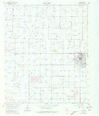
The community of Olton sits at the heart of this Lamb County landscape as it appeared in the early 1960s. The town layout is clearly defined, showing the grid of streets and key civic markers like the High Sch and an adjacent Athletic Field. On the southern edge of the settlement, the Olton Country Club provided a recreational focal point for residents during this era of post-war growth on the Texas High Plains.
Find a feature on this map
6 named features on this map. Tap any name to fly to it.
Don’t see what you’re looking for? This feature index may not catch every label — zoom into the map to look around manually.
Map Details
Editions of this 1963 Olton Map
2 editions found
Other maps of this area

1954 · Clovis
USGS Topo · 1:250,000

1958 · Clovis
USGS Topo · 1:250,000

1962 · Cofferville
USGS Topo · 1:24,000

1962 · Springlake
USGS Topo · 1:24,000

1962 · Fieldton
USGS Topo · 1:24,000

1963 · Dodd SE
USGS Topo · 1:24,000

1963 · Hart SW
USGS Topo · 1:24,000

1965 · Hilburn
USGS Topo · 1:24,000
1968 · Corry
USGS Topo · 1:24,000
1968 · Olton NE
USGS Topo · 1:24,000