
Loading...
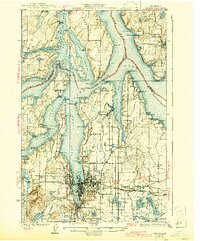
Loading map...1937 Map of Olympia
USGS Topo · Published 1937About this map
The southern reaches of Puget Sound dominate this mid-1930s survey, illustrating a landscape defined by deep inlets and developing coastal settlements. Olympia and Tumwater serve as the primary hubs, with the Northern Pacific RR and Union Pacific RR connecting the capital to the timber and maritime economies of the region. The map captures the intricate geography of the sound, from the Squaxin Island Reservation to the long stretches of Case Inlet and Eld Inlet.
Find a feature on this map
135 named features on this map. Tap any name to fly to it.
Don’t see what you’re looking for? This feature index may not catch every label — zoom into the map to look around manually.
Map Details
Date Portrayed1937
Date Published1937
PublisherU.S. Geological Survey
Map TypeTopographic
Scale1:62500
Physical Dimensions16.53 x 19.94 inches
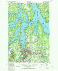
Editions of this 1937 Olympia Map
2 editions found
Historical Maps of Barnes Lake Condominiums Through Time
Featured Locations
Source Details
SourceU.S. Geological Survey
CopyrightPublic Domain