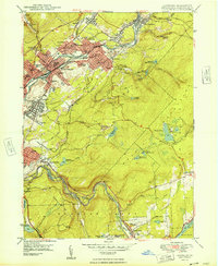
1948 Map of Olyphant
USGS Topo · Published 1948About this map
The Lackawanna River corridor serves as the industrial and social spine of this region, where a dense cluster of coal-era boroughs including Olyphant, Blakely, and Dickson City sit tightly packed along the valley floor. The landscape is defined by the complex transport network required to move anthracite, featuring a heavy concentration of rail lines such as the Delaware and Hudson RR and the Erie RR.
Find a feature on this map
86 named features on this map. Tap any name to fly to it.
Don’t see what you’re looking for? This feature index may not catch every label — zoom into the map to look around manually.
Map Details
Editions of this 1948 Olyphant Map
2 editions found
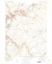
Other maps of this area

1889 · Scranton
USGS Topo · 1:62,500

1891 · Scranton
USGS Topo · 1:62,500

1892 · Honesdale
USGS Topo · 1:62,500

1892 · Dundaff
USGS Topo · 1:62,500

1893 · Scranton
USGS Topo · 1:62,500

1928 · Ariel
USGS Topo · 1:62,500

1932 · Ariel
USGS Topo · 1:62,500

1943 · Scranton
USGS Topo · 1:125,000

1943 · Honesdale
USGS Topo · 1:125,000

1946 · Dalton
USGS Topo · 1:24,000