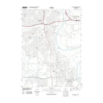
2010 Map of Omaha South
USGS Topo · Published 2010About this map
The Missouri River carves a winding path between Omaha, Nebraska, and Council Bluffs, Iowa, anchoring a landscape shaped by urban expansion and institutional growth. This 2010 survey details the industrial and residential corridors of South Omaha, where a dense concentration of local heritage sites, such as the Bohemian Cemetery and Saint Marys Cemetery, mark the community's cultural roots. Further south, the map transitions into the academic and residential fabric of Bellevue, showing the campus of Bellevue University and the historical footprint near Sarpys Trading Post.
Find a feature on this map
69 named features on this map. Tap any name to fly to it.
Don’t see what you’re looking for? This feature index may not catch every label — zoom into the map to look around manually.
Map Details
Editions of this 2010 Omaha South Map
This is the sole edition of this map. No revisions or reprints were ever made.
Other maps of this area

1893 · Omaha
USGS Topo · 1:62,500

1893 · Fremont
USGS Topo · 1:125,000

1896 · Fremont
USGS Topo · 1:125,000

1954 · Omaha
USGS Topo · 1:250,000

1955 · Fremont
USGS Topo · 1:250,000

1956 · Cedar Creek
USGS Topo · 1:24,000

1956 · Ralston
USGS Topo · 1:24,000

1956 · Irvington
USGS Topo · 1:24,000

1956 · Plattsmouth
USGS Topo · 1:24,000

1956 · Council Bluffs North
USGS Topo · 1:24,000