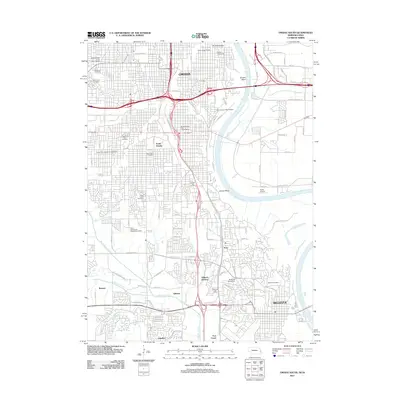
2011 Map of Omaha South
USGS Topo · Published 2011About this map
The Missouri River carves a winding path through the heart of the eastern Nebraska urban corridor, defining the sharp bends at Omaha Bend and Gibson Bend. This landscape transitions from the dense urban grid of Omaha and South Omaha into the residential and academic reaches of Bellevue. The map reveals a high concentration of local history markers, particularly through its numerous religious and ethnic burial grounds such as the Bohemian Cemetery and Beth Hamedrosh Hagodel Cemetery. Institutional footprints are visible at Grace University and Bellevue University, while the western periphery maintains pockets of rural character near the Bellevue Berry Farm. Local transportation and commerce are anchored by the Pierce Street Station and Ruckl Airport, while the hydrology is dominated by the Papillion Creek and Big Papillion Creek systems that drain the varied terrain of Douglas and Sarpy counties.
Find a feature on this map
125 named features on this map. Tap any name to fly to it.
Don’t see what you’re looking for? This feature index may not catch every label — zoom into the map to look around manually.
Map Details
Editions of this 2011 Omaha South Map
This is the sole edition of this map. No revisions or reprints were ever made.
Other maps of this area

1893 · Omaha
USGS Topo · 1:62,500

1893 · Fremont
USGS Topo · 1:125,000

1896 · Fremont
USGS Topo · 1:125,000

1954 · Omaha
USGS Topo · 1:250,000

1955 · Fremont
USGS Topo · 1:250,000

1956 · Cedar Creek
USGS Topo · 1:24,000

1956 · Ralston
USGS Topo · 1:24,000

1956 · Irvington
USGS Topo · 1:24,000

1956 · Plattsmouth
USGS Topo · 1:24,000

1956 · Council Bluffs North
USGS Topo · 1:24,000