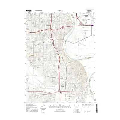
2014 Map of Omaha South
USGS Topo · Published 2014About this map
The Missouri River carves a massive bend between Nebraska and Iowa, anchoring this detailed look at the southern metropolitan corridor in the mid-2010s. The landscape is defined by the dense urban grid of Omaha and South Omaha, transitioning south through the historic aviation and military grounds of Offutt AFB and the city of Bellevue. This survey documents a profound concentration of heritage sites, particularly a string of ethnic and religious burial grounds including the Bohemian Cem, Saint Mary Magdalene Cem, and Beth Hamedrosh Hagodel Cem. Significant industrial and transportation arteries are visible, such as the Union Pacific RR corridors and the sweeping path of Veterans Memorial Hwy. Beyond the city limits, the terrain softens into the drainage basins of Big Papillion Creek and Mud Cr, showing the interface between established neighborhoods and the educational campus of Bellevue Univ.
Find a feature on this map
51 named features on this map. Tap any name to fly to it.
Don’t see what you’re looking for? This feature index may not catch every label — zoom into the map to look around manually.
Map Details
Editions of this 2014 Omaha South Map
This is the sole edition of this map. No revisions or reprints were ever made.
Other maps of this area

1893 · Omaha
USGS Topo · 1:62,500

1893 · Fremont
USGS Topo · 1:125,000

1896 · Fremont
USGS Topo · 1:125,000

1954 · Omaha
USGS Topo · 1:250,000

1955 · Fremont
USGS Topo · 1:250,000

1956 · Cedar Creek
USGS Topo · 1:24,000

1956 · Ralston
USGS Topo · 1:24,000

1956 · Irvington
USGS Topo · 1:24,000

1956 · Plattsmouth
USGS Topo · 1:24,000

1956 · Council Bluffs North
USGS Topo · 1:24,000