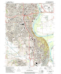
1994 Map of Omaha South
USGS Topo · Published 1995About this map
Offutt Air Force Base anchor the southern edge of this Missouri River corridor, where the urban expansion of Omaha and Bellevue meets the industrial and military landscape of the mid-1990s. The map captures the dense network of ethnic and parochial institutions in South Omaha, including St Bridgets Sch, St Stanislaus Sch, and St Mary Magdalene Sch, reflecting the deep-rooted community history of the stockyards district. Along the Missouri River, the transition from the manicured grounds of Riverside Park to the industrial infrastructure near Council Bluffs is evident.
Find a feature on this map
102 named features on this map. Tap any name to fly to it.
Don’t see what you’re looking for? This feature index may not catch every label — zoom into the map to look around manually.
Map Details
Editions of this 1994 Omaha South Map
This is the sole edition of this map. No revisions or reprints were ever made.
Other maps of this area

1893 · Omaha
USGS Topo · 1:62,500

1893 · Fremont
USGS Topo · 1:125,000

1896 · Fremont
USGS Topo · 1:125,000

1954 · Omaha
USGS Topo · 1:250,000

1955 · Fremont
USGS Topo · 1:250,000

1956 · Cedar Creek
USGS Topo · 1:24,000

1956 · Ralston
USGS Topo · 1:24,000

1956 · Irvington
USGS Topo · 1:24,000

1956 · Plattsmouth
USGS Topo · 1:24,000

1956 · Council Bluffs North
USGS Topo · 1:24,000