
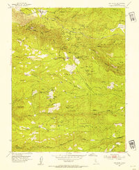
1952 Map of Omo Ranch
USGS Topo · Published 1986About this map
Omo Ranch and the historical Brownsville settlement area anchor this mid-century topographic record of the Eldorado National Forest in California. The landscape is heavily defined by its 19th-century gold and copper mining heritage, centered around the sprawling Henrys Diggings and numerous individual operations like the Cosumnes Copper Mine, Caldor Mine, and Washington Mine. These mining sites are concentrated along the complex drainages of the Middle Fork Cosumnes River and its many tributaries, including Sopiago Creek and Slug Gulch.
Find a feature on this map
94 named features on this map. Tap any name to fly to it.
Don’t see what you’re looking for? This feature index may not catch every label — zoom into the map to look around manually.
Map Details
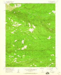
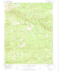
Editions of this 1952 Omo Ranch Map
5 editions found

Other maps of this area

1889 · Jackson
USGS Topo · 1:125,000

1889 · Pyramid Peak
USGS Topo · 1:125,000

1891 · Big Trees
USGS Topo · 1:125,000

1891 · Placerville
USGS Topo · 1:125,000

1891 · Pyramid Peak
USGS Topo · 1:125,000

1892 · Jackson
USGS Topo · 1:125,000

1892 · Placerville
USGS Topo · 1:125,000

1893 · Placerville
USGS Topo · 1:125,000

1894 · Big Trees
USGS Topo · 1:125,000

1895 · Pyramid Peak
USGS Topo · 1:125,000