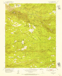
1952 Map of Omo Ranch
USGS Topo · Published 1954About this map
Omo Ranch and the gold-mining district of Henry's Diggings define this mid-century survey of the Eldorado National Forest. The landscape is a dense network of extraction history, where the forks of the Steely Fork, Middle Fork, and South Fork Cosumnes River cut through high ridges like Barney Ridge and Farnham Ridge. Gold-era relics are everywhere, from the Independence Mine to the site of Brownsville. A notable pattern of early settlement is visible through the positioning of the Indian Diggings School and the Willow School, which served the scattered families of the timber and mining camps. Genealogical details like the Andreason Cemetery and the Andreason Mill site offer specific evidence of the families who worked these slopes before the transition to modern forest management.
Find a feature on this map
91 named features on this map. Tap any name to fly to it.
Don’t see what you’re looking for? This feature index may not catch every label — zoom into the map to look around manually.
Map Details
Editions of this 1952 Omo Ranch Map
5 editions found
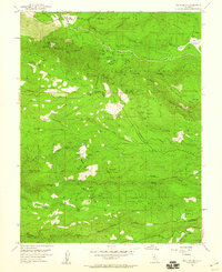
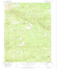


Other maps of this area

1889 · Jackson
USGS Topo · 1:125,000

1889 · Pyramid Peak
USGS Topo · 1:125,000

1891 · Big Trees
USGS Topo · 1:125,000

1891 · Placerville
USGS Topo · 1:125,000

1891 · Pyramid Peak
USGS Topo · 1:125,000

1892 · Jackson
USGS Topo · 1:125,000

1892 · Placerville
USGS Topo · 1:125,000

1893 · Placerville
USGS Topo · 1:125,000

1894 · Big Trees
USGS Topo · 1:125,000

1895 · Pyramid Peak
USGS Topo · 1:125,000