
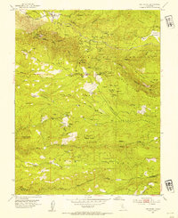
1952 Map of Omo Ranch
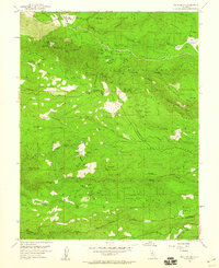
USGS Topo · Published 1975About this map
Henrys Diggings and the surrounding Sierra foothills define this landscape, where mining activity once blanketed the ridges and gulches north of Omo Ranch. The map reveals a dense concentration of named claims and workings, including the Gloryanna Mine, Caldor Mine, and the Gold Note Mine near Sopiago Creek. These sites reflect the intensive resource extraction that shaped local development from the mid-19th century onward.
Find a feature on this map
92 named features on this map. Tap any name to fly to it.
Don’t see what you’re looking for? This feature index may not catch every label — zoom into the map to look around manually.
Map Details
Editions of this 1952 Omo Ranch Map
5 editions found
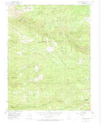

Other maps of this area

1889 · Jackson
USGS Topo · 1:125,000

1889 · Pyramid Peak
USGS Topo · 1:125,000

1891 · Big Trees
USGS Topo · 1:125,000

1891 · Placerville
USGS Topo · 1:125,000

1891 · Pyramid Peak
USGS Topo · 1:125,000

1892 · Jackson
USGS Topo · 1:125,000

1892 · Placerville
USGS Topo · 1:125,000

1893 · Placerville
USGS Topo · 1:125,000

1894 · Big Trees
USGS Topo · 1:125,000

1895 · Pyramid Peak
USGS Topo · 1:125,000