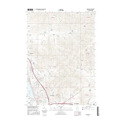
2015 Map of Onalaska
USGS Topo · Published 2015About this map
Onalaska and Holmen anchor this detailed study of the upper Mississippi River valley during a period of significant suburban expansion and residential development. The landscape is defined by its dramatic coulees—steep-walled valleys that drain the high ridges toward Lake Onalaska and the Mississippi floodplains. Notable terrain features like Camel Hump and Sugarloaf rise above the growing street grids, while numerous family-named valleys such as Sweden Coulee and Casberg Coulee reveal the rural legacy of the area. For genealogists and local historians, the presence of the Halfway Creek Cem near Halfway Cr serves as a vital marker of early settlement patterns. To the south, the industrial and logistical footprint of the region is evident near French Island and the La Crosse Municipal Airport, where the urban edge of La Crosse meets the river's backwaters.
Find a feature on this map
173 named features on this map. Tap any name to fly to it.
Don’t see what you’re looking for? This feature index may not catch every label — zoom into the map to look around manually.
Map Details
Editions of this 2015 Onalaska Map
This is the sole edition of this map. No revisions or reprints were ever made.
Other maps of this area

1926 · North Bend
USGS Topo · 1:62,500

1927 · La Crosse
USGS Topo · 1:62,500

1929 · Galesville
USGS Topo · 1:62,500

1929 · North Bend
USGS Topo · 1:62,500

1930 · La Crescent
USGS Topo · 1:62,500

1930 · La Crosse
USGS Topo · 1:62,500

1953 · Eau Claire
USGS Topo · 1:250,000

1956 · La Crescent
USGS Topo · 1:62,500

1958 · Eau Claire
USGS Topo · 1:250,000

1958 · La Crosse
USGS Topo · 1:250,000