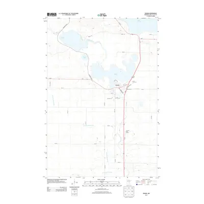
2013 Map of Onamia
USGS Topo · Published 2013About this map
Onamia serves as the central hub of this northern Minnesota landscape, situated at the southern tip of Lake Onamia. The town's geographic importance is defined by its position along the Rum River, which drains out of the massive Mille Lacs Lake just to the north and winds its way southward through the center of the sheet. This drainage system creates a network of interconnected water bodies, including Shakopee Lake and Warren Lake, interspersed with wetlands and low-lying terrain. The transportation corridor of Us-169 and MN-27 intersects within the town, providing the primary access through this wooded and water-rich region. Local heritage is preserved in the presence of several community landmarks, including Crosier Cem, Holy Cross Cem, and Mt Pleasant Cem. The map also details the Swiderski Field Airport to the south, highlighting the modern infrastructure supporting this rural lakeside community.
Find a feature on this map
34 named features on this map. Tap any name to fly to it.
Don’t see what you’re looking for? This feature index may not catch every label — zoom into the map to look around manually.
Map Details
Editions of this 2013 Onamia Map
This is the sole edition of this map. No revisions or reprints were ever made.
Other maps of this area

1953 · Duluth
USGS Topo · 1:250,000

1953 · Stillwater
USGS Topo · 1:250,000

1955 · Stillwater
USGS Topo · 1:250,000

1958 · Stillwater
USGS Topo · 1:250,000

1958 · Duluth
USGS Topo · 1:250,000

1965 · Stillwater
USGS Topo · 1:250,000

1968 · Onamia NW
USGS Topo · 1:24,000

1968 · Ramey NE
USGS Topo · 1:24,000

1968 · Milaca NE
USGS Topo · 1:24,000

1968 · Onamia
USGS Topo · 1:24,000