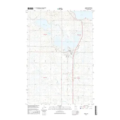
2016 Map of Onamia
USGS Topo · Published 2016About this map
Onamia serves as the central hub of this northern landscape, situated where the Rum River flows south from Lake Onamia. The settlement pattern is defined by its proximity to several significant water bodies, including the southern edge of Mille Lacs Lake and the marshy basins of Shakopee Lake and Warren Lake. These glacial lakes and interconnected waterways illustrate a region deeply shaped by its post-glacial hydrology. Local heritage is preserved in the cluster of burial grounds near the town site, including Crosier Cem, Holy Cross Cem, and Mount Pleasant Cem. The surrounding townships are crisscrossed by a grid of rural routes such as Pony Farm Rd and Tamarac Rd, while the DNR Trl follows an old linear corridor through the wetlands, hinting at former transportation lines. To the south, the landscape opens into the drainages of N Fork Bradbury Brook and S Fork Bradbury Brook, marked by the private airstrip at Swiderski Field.
Find a feature on this map
51 named features on this map. Tap any name to fly to it.
Don’t see what you’re looking for? This feature index may not catch every label — zoom into the map to look around manually.
Map Details
Editions of this 2016 Onamia Map
This is the sole edition of this map. No revisions or reprints were ever made.
Other maps of this area

1953 · Duluth
USGS Topo · 1:250,000

1953 · Stillwater
USGS Topo · 1:250,000

1955 · Stillwater
USGS Topo · 1:250,000

1958 · Stillwater
USGS Topo · 1:250,000

1958 · Duluth
USGS Topo · 1:250,000

1965 · Stillwater
USGS Topo · 1:250,000

1968 · Onamia NW
USGS Topo · 1:24,000

1968 · Ramey NE
USGS Topo · 1:24,000

1968 · Milaca NE
USGS Topo · 1:24,000

1968 · Onamia
USGS Topo · 1:24,000