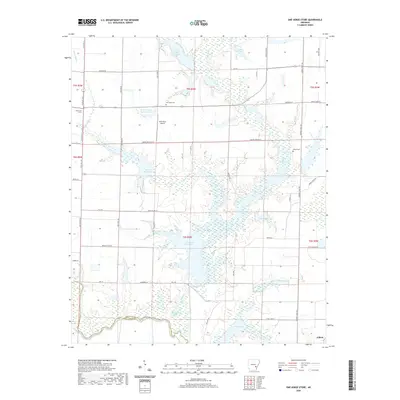
2020 Map of One Horse Store
USGS Topo · Published 2020About this map
Bayou Meto defines the southern border of this Arkansas County landscape, winding through a complex system of bottomlands and reservoirs. The area is characterized by an intricate drainage network including Pecan Bayou, Hurricane Bayou, and Mill Bayou, which support numerous man-made water bodies such as Loyd Rodgers Reservoir and Lumsdens Reservoir. This hydrological pattern reflects the region's agricultural dependency on water management for rice and crop irrigation.
Find a feature on this map
58 named features on this map. Tap any name to fly to it.
Don’t see what you’re looking for? This feature index may not catch every label — zoom into the map to look around manually.
Map Details
Editions of this 2020 One Horse Store Map
This is the sole edition of this map. No revisions or reprints were ever made.
Other maps of this area

1935 · Varner
USGS Topo · 1:62,500

1935 · Gillett
USGS Topo · 1:62,500

1941 · De Witt
USGS Topo · 1:62,500

1941 · Goldman
USGS Topo · 1:62,500

1948 · Helena
USGS Topo · 1:250,000

1950 · Helena
USGS Topo · 1:250,000

1954 · De Witt
USGS Topo · 1:62,500

1955 · Helena
USGS Topo · 1:250,000

1959 · Helena
USGS Topo · 1:250,000

1960 · Helena
USGS Topo · 1:250,000