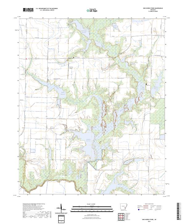
2024 Map of One Horse Store
USGS Topo · Published 2024About this map
Bayou Meto and its associated wetlands define the southern reaches of this landscape, where the Dale Bumpers White River National Wildlife Refuge preserves a critical riparian ecosystem. The map reveals a complex hydraulic network of bayous, lakes, and modern reservoirs used for irrigation and water management across the Arkansas Delta. Water bodies like Pecan Lake, Haller Lake, and Lake Wilson are interspersed with agricultural infrastructure and local landmarks such as Sids Place Airport. Small family and community ties are evident in the presence of the Van Camp Cem and Haller Cem, located near the intersection of various local routes like Van Camp Rd and Gander Street Rd. This modern survey details how the land has been organized into large-scale agricultural tracts while maintaining the natural drainage patterns of Pecan Bayou and Mill Bayou.
Find a feature on this map
60 named features on this map. Tap any name to fly to it.
Don’t see what you’re looking for? This feature index may not catch every label — zoom into the map to look around manually.
Map Details
Editions of this 2024 One Horse Store Map
This is the sole edition of this map. No revisions or reprints were ever made.
Other maps of this area

1935 · Varner
USGS Topo · 1:62,500

1935 · Gillett
USGS Topo · 1:62,500

1941 · De Witt
USGS Topo · 1:62,500

1941 · Goldman
USGS Topo · 1:62,500

1948 · Helena
USGS Topo · 1:250,000

1950 · Helena
USGS Topo · 1:250,000

1954 · De Witt
USGS Topo · 1:62,500

1955 · Helena
USGS Topo · 1:250,000

1959 · Helena
USGS Topo · 1:250,000

1960 · Helena
USGS Topo · 1:250,000