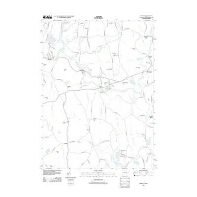
2012 Map of Oneco
USGS Topo · Published 2012About this map
The Moosup River winds through this borderland region between Connecticut and Rhode Island, connecting the industrial legacy of Sterling and Oneco with the rural reaches of Moosup Valley. The landscape is a mosaic of small mill ponds and upland heights, where landmarks like Webb Hill and the Sterling Fire Tower overlook the valley. This 2012 survey illustrates the persistence of early colonial settlement patterns through various family-named sites, including Gallups Cem and Vaughn Hollow. Significant tracts of public land are preserved within the Pachaug State Frst and the Arcadia Man Area, providing a buffer of conservation amidst the crossroads of Rice City and Fairbanks Corner. The presence of small aviation infrastructure like Riconn Airport and numerous water bodies such as Carbuncle Pond and Wickaboxet Pond underscores the area's mix of recreation and transportation.
Find a feature on this map
141 named features on this map. Tap any name to fly to it.
Don’t see what you’re looking for? This feature index may not catch every label — zoom into the map to look around manually.
Map Details
Editions of this 2012 Oneco Map
This is the sole edition of this map. No revisions or reprints were ever made.
Other maps of this area

1889 · Putnam
USGS Topo · 1:62,500

1889 · Burrillville
USGS Topo · 1:62,500

1889 · Moosup
USGS Topo · 1:62,500

1890 · Kent
USGS Topo · 1:62,500

1893 · Putnam
USGS Topo · 1:62,500

1893 · Moosup
USGS Topo · 1:62,500

1894 · Burrillville
USGS Topo · 1:62,500

1894 · Kent
USGS Topo · 1:62,500

1915 · Burrillville
USGS Topo · 1:62,500

1919 · Putnam
USGS Topo · 1:62,500