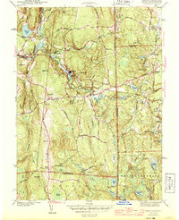
1944 Map of Oneco
USGS Topo · Published 1944About this map
Oneco and Sterling anchor this mid-century look at the Connecticut-Rhode Island borderlands, where the Moosup River carves a path through the rolling terrain of Windham and Kent counties. The industrial and transit patterns of the 1940s are evident in the route of the New York New Haven and Hartford railroad and the Plainfield Pike, which connect local settlements like Almyville and Rice City.
Find a feature on this map
55 named features on this map. Tap any name to fly to it.
Don’t see what you’re looking for? This feature index may not catch every label — zoom into the map to look around manually.
Map Details
Editions of this 1944 Oneco Map
2 editions found
Other maps of this area

1889 · Putnam
USGS Topo · 1:62,500

1889 · Burrillville
USGS Topo · 1:62,500

1889 · Moosup
USGS Topo · 1:62,500

1890 · Kent
USGS Topo · 1:62,500

1893 · Putnam
USGS Topo · 1:62,500

1893 · Moosup
USGS Topo · 1:62,500

1894 · Burrillville
USGS Topo · 1:62,500

1894 · Kent
USGS Topo · 1:62,500

1915 · Burrillville
USGS Topo · 1:62,500

1919 · Putnam
USGS Topo · 1:62,500