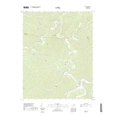
2019 Map of Oneida
USGS Topo · Published 2019About this map
The South Fork Kentucky River meanders deeply through the sharp terrain of Clay and Owsley Counties, creating distinctive geographical features like Grapevine Bend and Bishop Bend. The settlement of Oneida sits at the southern confluence where the Red Bird River and Goose Creek join the main river. This landscape is defined by its many hollows and gaps, such as Pole Cat Hollow, Hoot Owl Hollow, and Felty Gap, which historically dictated the placement of small communities and family cemeteries. Genealogists will find several burial sites recorded across these ridges, including Sizemore Cem, Middleton Cem, and the Williams Cem. Small settlements like Trixie, Teges, and Ammie are connected by winding roads that follow the natural contours of the valley floors, while the narrow passage known as The Narrows highlights the restrictive river geography that shaped local development.
Find a feature on this map
78 named features on this map. Tap any name to fly to it.
Don’t see what you’re looking for? This feature index may not catch every label — zoom into the map to look around manually.
Map Details
Editions of this 2019 Oneida Map
This is the sole edition of this map. No revisions or reprints were ever made.
Other maps of this area

1891 · Manchester
USGS Topo · 1:125,000

1952 · Manchester
USGS Topo · 1:24,000

1953 · Oneida
USGS Topo · 1:24,000

1953 · Cowcreek
USGS Topo · 1:24,000

1953 · Big Creek
USGS Topo · 1:24,000

1953 · Mistletoe
USGS Topo · 1:24,000

1953 · Booneville
USGS Topo · 1:24,000

1953 · Sturgeon
USGS Topo · 1:24,000

1954 · Barcreek
USGS Topo · 1:24,000

1954 · Maulden
USGS Topo · 1:24,000