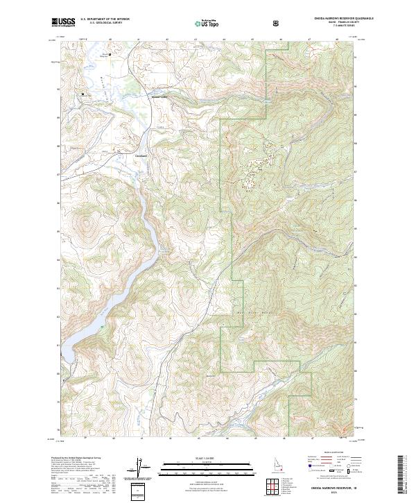
2023 Map of Oneida Narrows Reservoir
USGS Topo · Published 2023About this map
Mound Valley and the small settlement of Cleveland anchor this corner of Franklin County, where the Bear River winds through the high desert and agricultural landscape. The map reveals an intricate network of water management essential to this region, featuring the Cleveland-Irrigation Canal and the Mink Creek Canal, which divert resources across the complex terrain of the Bear River Range. Local history is preserved in the location of the Valley Cem and Cleveland Cem, while the natural geothermic activity of the area is highlighted at Maple Grove Hot Springs. Rising above the valley, features like Devils Hill and the geological curiosity known as The Sinks define the rugged eastern portions of the quadrangle within the Cache National Forest.
Find a feature on this map
55 named features on this map. Tap any name to fly to it.
Don’t see what you’re looking for? This feature index may not catch every label — zoom into the map to look around manually.
Map Details
Editions of this 2023 Oneida Narrows Reservoir Map
This is the sole edition of this map. No revisions or reprints were ever made.
Other maps of this area

1915 · Preston
USGS Topo · 1:96,000

1918 · Preston
USGS Topo · 1:125,000

1955 · Preston
USGS Topo · 1:250,000

1958 · Preston
USGS Topo · 1:250,000

1962 · Preston
USGS Topo · 1:250,000
1969 · Midnight Mtn
USGS Topo · 1:24,000
1969 · Treasureton
USGS Topo · 1:24,000
1969 · Mink Creek
USGS Topo · 1:24,000
1969 · North Canyon
USGS Topo · 1:24,000
1969 · Paris Peak
USGS Topo · 1:24,000