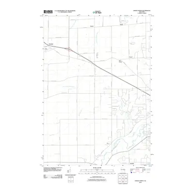
2010 Map of Oneida North
USGS Topo · Published 2010About this map
Duck Creek and Trout Creek carve through this landscape northwest of Green Bay, defining the drainage patterns for settlements like Hobart and Mill Center. The map reveals a rural community structured by a grid of county highways and family-named roads, such as Matuszak Ct and Robin Ln. Small residential clusters at Kunesh and Anston sit amidst a network of riparian corridors, including the West Branch Suamico River and the South Branch Suamico River.
Find a feature on this map
53 named features on this map. Tap any name to fly to it.
Don’t see what you’re looking for? This feature index may not catch every label — zoom into the map to look around manually.
Map Details
Editions of this 2010 Oneida North Map
This is the sole edition of this map. No revisions or reprints were ever made.
Other maps of this area

1954 · De Pere
USGS Topo · 1:62,500

1954 · Green Bay West
USGS Topo · 1:24,000

1954 · De Pere
USGS Topo · 1:24,000

1954 · Green Bay
USGS Topo · 1:62,500

1955 · Appleton
USGS Topo · 1:62,500

1955 · Seymour
USGS Topo · 1:62,500

1955 · Green Bay
USGS Topo · 1:250,000

1974 · Seymour
USGS Topo · 1:24,000

1974 · Zachow
USGS Topo · 1:24,000
1974 · Oneida South
USGS Topo · 1:24,000