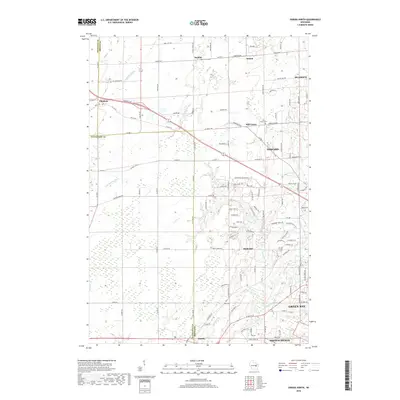
2018 Map of Oneida North
USGS Topo · Published 2018About this map
Duck Creek and its various tributaries, including Trout Cr, carve through the landscape northwest of Green Bay in this recent survey. The map details the transition from rural crossroads like Kunesh and Anston to the expanding residential outskirts of Howard, Hobart, and Ashwaubenon. Notable for genealogists are the several local burial grounds, such as Kunesh Cem and Mill Center Cem, which provide historical touchpoints for the early communities of Brown and Outagamie counties.
Find a feature on this map
80 named features on this map. Tap any name to fly to it.
Don’t see what you’re looking for? This feature index may not catch every label — zoom into the map to look around manually.
Map Details
Editions of this 2018 Oneida North Map
This is the sole edition of this map. No revisions or reprints were ever made.
Other maps of this area

1954 · De Pere
USGS Topo · 1:62,500

1954 · Green Bay West
USGS Topo · 1:24,000

1954 · De Pere
USGS Topo · 1:24,000

1954 · Green Bay
USGS Topo · 1:62,500

1955 · Appleton
USGS Topo · 1:62,500

1955 · Seymour
USGS Topo · 1:62,500

1955 · Green Bay
USGS Topo · 1:250,000

1974 · Seymour
USGS Topo · 1:24,000

1974 · Zachow
USGS Topo · 1:24,000
1974 · Oneida South
USGS Topo · 1:24,000