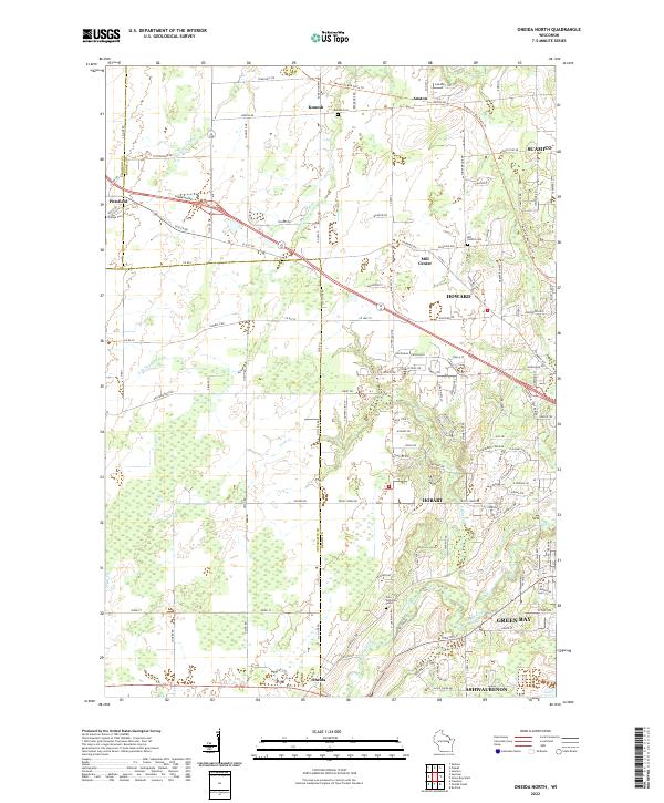
2022 Map of Oneida North
USGS Topo · Published 2022About this map
Kunesh and Mill Center anchor a landscape defined by small agrarian settlements and the winding paths of the S Br Suamico River and Trout Cr. This survey illustrates the transition from traditional farming communities to expanding residential areas near Howard and Green Bay. For genealogists and local historians, several landmarks are clearly noted, including Owego Cem in Pittsfield and the Zion Lutheran Cem further south. The Mountain-Bay State Trl cuts across the northern terrain, following an older rail alignment through Anston. The map also captures the administrative boundaries where Shawano Co meets Brown Co, and where the landscape moves into the Oneida community. The drainage patterns of Duck Creek and its tributaries show how the hydrology of the region influenced the placement of early roads like Old 29 Rd and Shawano Ave.
Find a feature on this map
127 named features on this map. Tap any name to fly to it.
Don’t see what you’re looking for? This feature index may not catch every label — zoom into the map to look around manually.
Map Details
Editions of this 2022 Oneida North Map
This is the sole edition of this map. No revisions or reprints were ever made.
Other maps of this area

1954 · De Pere
USGS Topo · 1:62,500

1954 · Green Bay West
USGS Topo · 1:24,000

1954 · De Pere
USGS Topo · 1:24,000

1954 · Green Bay
USGS Topo · 1:62,500

1955 · Appleton
USGS Topo · 1:62,500

1955 · Seymour
USGS Topo · 1:62,500

1955 · Green Bay
USGS Topo · 1:250,000

1974 · Seymour
USGS Topo · 1:24,000

1974 · Zachow
USGS Topo · 1:24,000
1974 · Oneida South
USGS Topo · 1:24,000