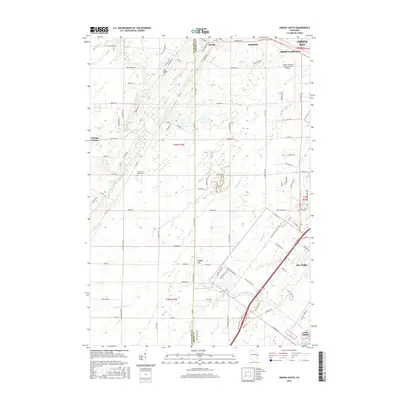
2016 Map of Oneida South
USGS Topo · Published 2016About this map
Oneida and Hobart lie at the heart of this landscape where the boundaries of Outagamie and Brown Counties meet. The terrain is defined by a dense network of tributaries including Duck Creek, Dutchman Creek, and the various branches of Ashwaubenon Creek, all draining toward the Fox River in the southeast near Little Rapids. This era shows a mix of established community centers like Chicago Corners alongside significant infrastructure, most notably the Austin Straubel International Airport which occupies a large footprint in Ashwaubenon. Local history is anchored by several sites of interment, including Saint Joseph Cemetery and the Church of Christ Cemetery. Significant landmarks such as Gopher Hill provide vertical relief in an area otherwise characterized by the steady growth of suburbs surrounding Green Bay and De Pere.
Find a feature on this map
101 named features on this map. Tap any name to fly to it.
Don’t see what you’re looking for? This feature index may not catch every label — zoom into the map to look around manually.
Map Details
Editions of this 2016 Oneida South Map
This is the sole edition of this map. No revisions or reprints were ever made.
Other maps of this area

1954 · De Pere
USGS Topo · 1:62,500

1954 · Green Bay West
USGS Topo · 1:24,000

1954 · De Pere
USGS Topo · 1:24,000

1954 · Green Bay
USGS Topo · 1:62,500

1955 · Appleton
USGS Topo · 1:62,500

1955 · Seymour
USGS Topo · 1:62,500

1955 · Green Bay
USGS Topo · 1:250,000

1974 · Seymour
USGS Topo · 1:24,000

1974 · Kaukauna
USGS Topo · 1:24,000

1974 · Greenleaf
USGS Topo · 1:24,000