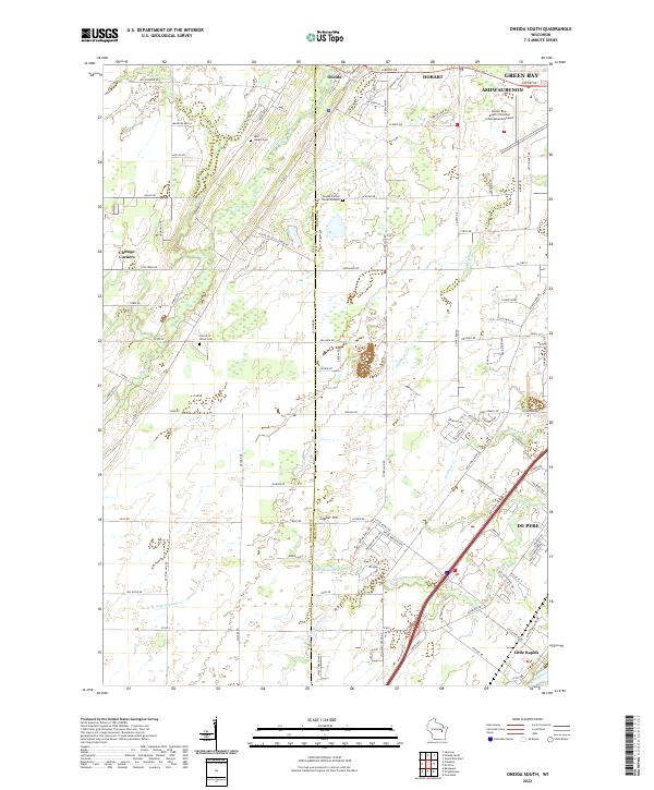
2022 Map of Oneida South
USGS Topo · Published 2022About this map
The settlement of Oneida and its surrounding rural landscapes are captured here at the boundary of Outagamie and Brown counties. This area is characterized by a network of creeks, including Duck Creek, Dutchman Creek, and the many branches of Ashwaubunon Creek, which drain toward the Fox River near Little Rapids. The geography is significant for its Indigenous heritage and cultural landmarks, notably the Oneida Sacred Burial Grounds and several community religious sites such as Saint Joseph Cemetery and Church of Christ Cemetery.
Find a feature on this map
152 named features on this map. Tap any name to fly to it.
Don’t see what you’re looking for? This feature index may not catch every label — zoom into the map to look around manually.
Map Details
Editions of this 2022 Oneida South Map
This is the sole edition of this map. No revisions or reprints were ever made.
Other maps of this area

1954 · De Pere
USGS Topo · 1:62,500

1954 · Green Bay West
USGS Topo · 1:24,000

1954 · De Pere
USGS Topo · 1:24,000

1954 · Green Bay
USGS Topo · 1:62,500

1955 · Appleton
USGS Topo · 1:62,500

1955 · Seymour
USGS Topo · 1:62,500

1955 · Green Bay
USGS Topo · 1:250,000

1974 · Seymour
USGS Topo · 1:24,000

1974 · Kaukauna
USGS Topo · 1:24,000

1974 · Greenleaf
USGS Topo · 1:24,000