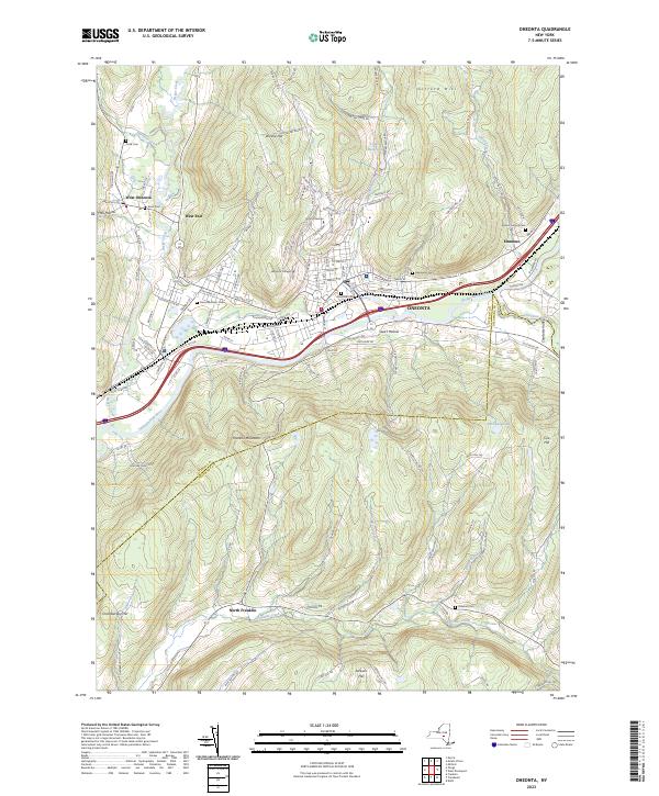
2023 Map of Oneonta
USGS Topo · Published 2023About this map
Oneonta serves as the focal point of this Otsego County landscape, where the Susquehanna River meets the drainages of Oneonta Creek and Otego Creek. The city's educational legacy is clearly defined by the sprawling campuses of Hartwick College and SUNY Oneonta, both situated on the rising slopes north of the central business district. Surrounding the urban center, smaller settlements like West Oneonta, West End, and Emmons follow the valley floors, while the rugged topography of Franklin Mountain and Gifford Hill hems in the river corridor. A high density of burial grounds, including the large Riverside Cem and Oneonta Plains Cem, provides significant genealogical touchpoints across the quadrangle. The map also traces the transition into Delaware County to the south, marked by the winding course of Ouleout Creek near the village of North Franklin.
Find a feature on this map
124 named features on this map. Tap any name to fly to it.
Don’t see what you’re looking for? This feature index may not catch every label — zoom into the map to look around manually.
Map Details
Editions of this 2023 Oneonta Map
This is the sole edition of this map. No revisions or reprints were ever made.
Other maps of this area

1907 · Cooperstown
USGS Topo · 1:62,500

1909 · Cooperstown
USGS Topo · 1:62,500

1909 · Delhi
USGS Topo · 1:62,500

1910 · Hartwick
USGS Topo · 1:62,500

1911 · Delhi
USGS Topo · 1:62,500

1912 · Hartwick
USGS Topo · 1:62,500

1915 · Oneonta
USGS Topo · 1:62,500

1918 · Oneonta
USGS Topo · 1:62,500

1943 · Delhi
USGS Topo · 1:24,000

1943 · Mt Vision
USGS Topo · 1:24,000