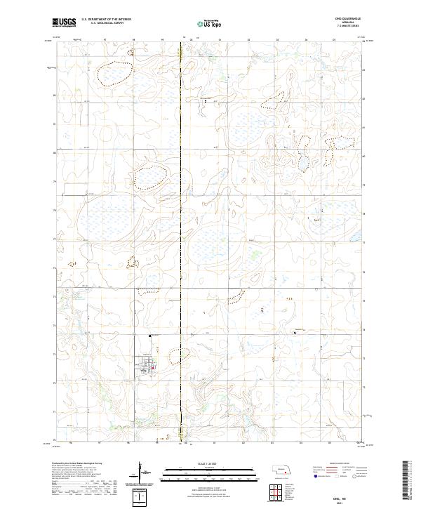
2021 Map of Ong
USGS Topo · Published 2021About this map
Ong anchors the southern portion of this landscape, positioned along the border between Clay County and Fillmore County. The town's grid is clearly defined by residential streets such as Minden St, Darley St, and Marney St, reflecting its role as a local center for the surrounding agricultural plains. The terrain is marked by the wandering paths of Little Sandy Creek and Turkey Creek, which weave through the section lines alongside numerous small wetlands and depressions.
Find a feature on this map
34 named features on this map. Tap any name to fly to it.
Don’t see what you’re looking for? This feature index may not catch every label — zoom into the map to look around manually.
Map Details
Editions of this 2021 Ong Map
This is the sole edition of this map. No revisions or reprints were ever made.
Other maps of this area

1898 · York
USGS Topo · 1:125,000

1898 · Hebron
USGS Topo · 1:125,000

1899 · York
USGS Topo · 1:125,000

1955 · Lincoln
USGS Topo · 1:250,000

1957 · Lincoln
USGS Topo · 1:250,000

1958 · Lincoln
USGS Topo · 1:250,000

1960 · Edgar
USGS Topo · 1:24,000

1960 · Davenport
USGS Topo · 1:24,000

1960 · Carleton
USGS Topo · 1:24,000
1969 · Ong
USGS Topo · 1:24,000