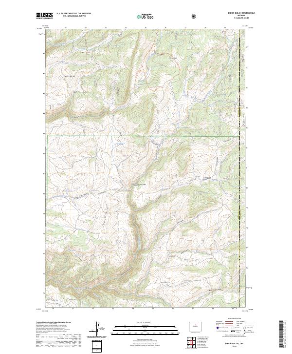
2023 Map of Onion Gulch
USGS Topo · Published 2023About this map
Bighorn National Forest dominates this landscape on the border of Washakie and Johnson Counties, where the dramatic elevation drops of the Big Horn Mountains are meticulously charted. The terrain is defined by deep incisions like Leigh Canyon and Canyon Creek Canyon, alongside distinctive geological formations such as the Leigh Creek Vee and Cooks Vee. Water sources are vital features here, from the Canyon Creek Sinks to numerous high-altitude water points like Healy Springs, Tolman Spring, and Box Spring.
Find a feature on this map
36 named features on this map. Tap any name to fly to it.
Don’t see what you’re looking for? This feature index may not catch every label — zoom into the map to look around manually.
Map Details
Editions of this 2023 Onion Gulch Map
This is the sole edition of this map. No revisions or reprints were ever made.
Other maps of this area

1899 · Cloud peak
USGS Topo · 1:125,000

1901 · Cloud Peak
USGS Topo · 1:125,000

1955 · Sheridan
USGS Topo · 1:250,000

1955 · Arminto
USGS Topo · 1:250,000

1958 · Sheridan
USGS Topo · 1:250,000

1958 · Arminto
USGS Topo · 1:250,000

1962 · Sheridan
USGS Topo · 1:250,000

1962 · Arminto
USGS Topo · 1:250,000

1966 · Monument Hill
USGS Topo · 1:24,000

1966 · Big Trails NE
USGS Topo · 1:24,000