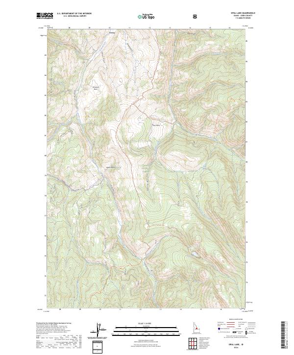
2024 Map of Opal Lake
USGS Topo · Published 2024About this map
The Yellowjacket Mountains dominate this high-elevation landscape within the Salmon National Forest, where the settlement of Forney sits at the northern edge. The geography is defined by a series of deep drainages and basins, most notably McGowan Basin, Moyer Basin, and Rooker Basin, which collect the waters of Panther Creek and its many tributaries. This modern survey reflects the enduring importance of historical transit and resource access, highlighting the Thunder Mountain Historic Trl and various mountain routes like the Meyers Cove Road (Winter Trl).
Find a feature on this map
37 named features on this map. Tap any name to fly to it.
Don’t see what you’re looking for? This feature index may not catch every label — zoom into the map to look around manually.
Map Details
Editions of this 2024 Opal Lake Map
This is the sole edition of this map. No revisions or reprints were ever made.
Other maps of this area

1950 · Blackbird Mtn
USGS Topo · 1:62,500

1950 · Leesburg
USGS Topo · 1:62,500

1951 · Leesburg
USGS Topo · 1:62,500

1951 · Blackbird Mtn
USGS Topo · 1:62,500

1956 · Elk City
USGS Topo · 1:250,000

1957 · Challis
USGS Topo · 1:250,000

1960 · Elk City
USGS Topo · 1:250,000

1960 · Challis
USGS Topo · 1:250,000

1963 · Challis
USGS Topo · 1:250,000
1963 · Opal Lake
USGS Topo · 1:24,000