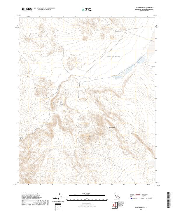
2021 Map of Opal Mountain
USGS Topo · Published 2021About this map
The Mojave Desert terrain of San Bernardino County dominates this 2021 study, characterized by rugged elevations and desert basins. The northern portion of the sheet is defined by the flat expanse of Superior Valley, while the central and southern reaches are marked by prominent volcanic features including Opal Mtn and Black Mtn. The landscape is etched by deep geological formations such as Inscription Canyon and Black Canyon, which offer insight into the natural drainage patterns of this arid environment. Navigation through this remote area is primarily facilitated by Black Canyon Rd, providing access to isolated landmarks like Scouts Cove. This survey preserves the exact placement of township and range boundaries, including t31s r45e, which are essential for property research and understanding the large-scale spatial organization of these desert lands.
Find a feature on this map
12 named features on this map. Tap any name to fly to it.
Don’t see what you’re looking for? This feature index may not catch every label — zoom into the map to look around manually.
Map Details
Editions of this 2021 Opal Mountain Map
This is the sole edition of this map. No revisions or reprints were ever made.
Other maps of this area

1915 · Searles Lake
USGS Topo · 1:250,000

1947 · Trona
USGS Topo · 1:250,000

1948 · Trona
USGS Topo · 1:250,000

1953 · Trona
USGS Topo · 1:250,000

1954 · Pilot Knob
USGS Topo · 1:62,500

1954 · Cuddeback Lake
USGS Topo · 1:62,500

1955 · Opal Mountain
USGS Topo · 1:62,500

1956 · Fremont Peak
USGS Topo · 1:62,500

1957 · Trona
USGS Topo · 1:250,000

1960 · Trona
USGS Topo · 1:250,000