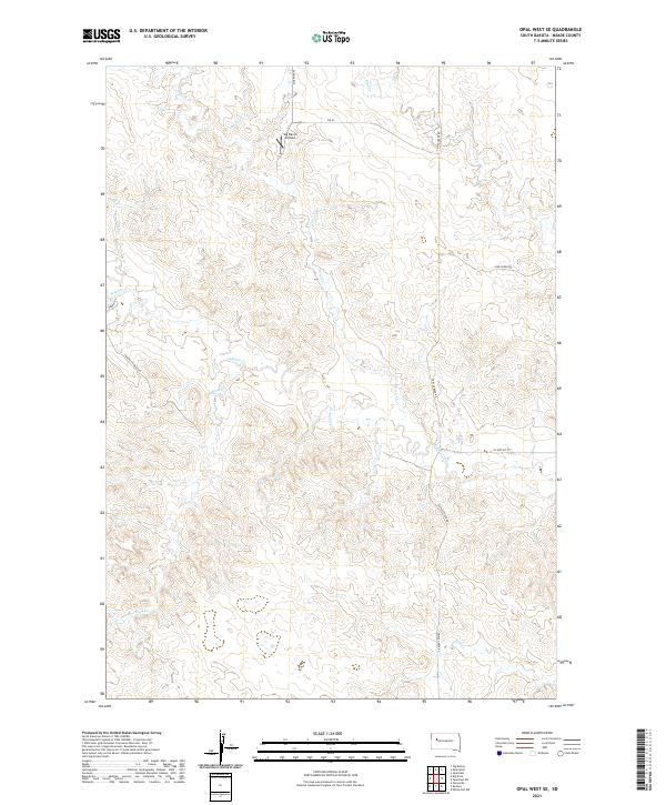
2021 Map of Opal West SE
USGS Topo · Published 2021About this map
Vig Ranch Airfield stands as a notable landmark in this section of Meade County, highlighting the importance of private aviation in the remote ranchlands of South Dakota. The terrain is defined by a dense network of drainage systems, including the branching reaches of Sulphur Cr, Horse Cr, and Rock Cr, which carve through the high plains. A singular topographic feature, the Poverty Pinnacles, rises above the surrounding landscape, providing a distinct navigational point for those traversing the local road network. The map details a transition from traditional section-line routes to more specialized paths like Quartize Pl, Vig Pl, and Triple Creek Rd, reflecting the modern infrastructure required to manage these large agricultural holdings. This survey captures a specific moment in the rural development of the region, where natural hydrology and ranching infrastructure intersect.
Find a feature on this map
19 named features on this map. Tap any name to fly to it.
Don’t see what you’re looking for? This feature index may not catch every label — zoom into the map to look around manually.
Map Details
Editions of this 2021 Opal West SE Map
This is the sole edition of this map. No revisions or reprints were ever made.
Other maps of this area

1953 · Rapid City
USGS Topo · 1:250,000

1957 · Rapid City
USGS Topo · 1:250,000

1959 · Redowl
USGS Topo · 1:24,000

1959 · Stoneville
USGS Topo · 1:24,000

1983 · Whiteman Owl NW
USGS Topo · 1:24,000

1983 · Opal West SE
USGS Topo · 1:24,000
1983 · Squaw Buttes
USGS Topo · 1:24,000
1983 · Opal East
USGS Topo · 1:24,000

1983 · Opal East SW
USGS Topo · 1:24,000
1983 · Big Draw
USGS Topo · 1:24,000