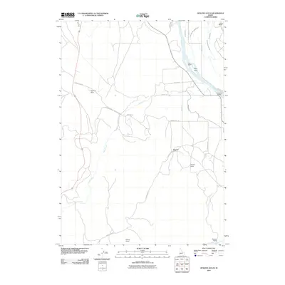
2010 Map of Opalene Gulch
USGS Topo · Published 2010About this map
The Snake River defines the northeastern boundary of this landscape, carving a path that creates distinctive landforms like Fruit Island, Dilley Island, and Cottontail Island. This high-desert terrain in Idaho is marked by a complex network of irrigation infrastructure essential to the region's agricultural life, including the South Canal, Deer Flat Low Line Canal, and Conroy Lateral. These waterworks contrast with the dry, dissected uplands where landmarks such as Elephant Butte, Liberty Butte, and the interestingly named Shares Snout rise above the surrounding gulches.
Find a feature on this map
30 named features on this map. Tap any name to fly to it.
Don’t see what you’re looking for? This feature index may not catch every label — zoom into the map to look around manually.
Map Details
Editions of this 2010 Opalene Gulch Map
This is the sole edition of this map. No revisions or reprints were ever made.
Other maps of this area

1892 · Silver City
USGS Topo · 1:125,000

1894 · Silver City
USGS Topo · 1:125,000

1898 · Nampa
USGS Topo · 1:125,000

1898 · Silver City
USGS Topo · 1:125,000

1955 · Boise
USGS Topo · 1:250,000

1957 · Opalene Gulch
USGS Topo · 1:24,000

1957 · Wilson Peak
USGS Topo · 1:24,000

1957 · Sands Basin
USGS Topo · 1:62,500

1958 · Boise
USGS Topo · 1:250,000
1958 · Givens Hot Springs
USGS Topo · 1:24,000