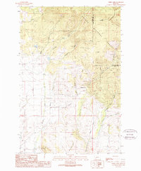
1989 Map of Ophir Creek
USGS Topo · Published 1989About this map
The Continental Divide anchors this high-elevation Montana landscape, tracing the border between Powell and Lewis and Clark counties. Steep ridges and deep gulches define the area, where the headwaters of Ophir Creek and Threemile Creek drain away from the peaks of Black Mountain and Illinois Ridge. This 1989 provisional survey highlights a landscape heavily marked by mineral exploration and extraction along the slopes, particularly near Blackfoot City.
Find a feature on this map
32 named features on this map. Tap any name to fly to it.
Don’t see what you’re looking for? This feature index may not catch every label — zoom into the map to look around manually.
Map Details
Editions of this 1989 Ophir Creek Map
This is the sole edition of this map. No revisions or reprints were ever made.
Other maps of this area

1889 · Helena
USGS Topo · 1:250,000

1893 · Helena
USGS Topo · 1:250,000

1899 · Helena
USGS Topo · 1:250,000

1903 · Helena
USGS Topo · 1:250,000

1947 · Butte
USGS Topo · 1:250,000

1958 · Butte
USGS Topo · 1:250,000

1958 · Avon
USGS Topo · 1:62,500

1959 · Elliston
USGS Topo · 1:62,500

1960 · Butte
USGS Topo · 1:250,000

1962 · Butte
USGS Topo · 1:250,000