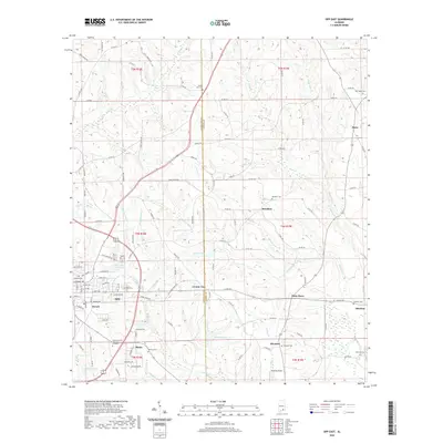
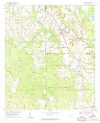
2020 Map of Opp East
USGS Topo · Published 2020About this map
The Covington and Coffee County line runs vertically through this landscape, dividing a region defined by agricultural creek bottoms and small crossroads settlements. To the west, the outskirts of Opp and the neighborhood of Duvall represent the primary residential center, while the surrounding countryside is dotted with legacy locales like Brooklyn, Alberton, and Perry Store. The terrain is characterized by the complex drainage of the Cripple Creek system, including W Fork Cripple Cr and E Fork Cripple Cr, which feed into the larger Cripple Cr basin.
Find a feature on this map
128 named features on this map. Tap any name to fly to it.
Don’t see what you’re looking for? This feature index may not catch every label — zoom into the map to look around manually.
Map Details
Editions of this 2020 Opp East Map
This is the sole edition of this map. No revisions or reprints were ever made.
Other maps of this area

1953 · Andalusia
USGS Topo · 1:250,000

1957 · Andalusia
USGS Topo · 1:250,000

1968 · Danleys Crossroads
USGS Topo · 1:24,000
1968 · Ino
USGS Topo · 1:24,000
1968 · Sellersville
USGS Topo · 1:24,000

1968 · Opp East
USGS Topo · 1:24,000
1968 · Elba
USGS Topo · 1:24,000
1969 · Kinston
USGS Topo · 1:24,000

1971 · Dozier
USGS Topo · 1:24,000

1971 · Onycha
USGS Topo · 1:24,000