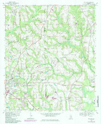
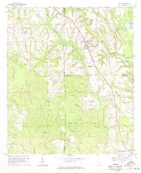
1968 Map of Opp East
USGS Topo · Published 1986About this map
The city of Opp serves as the focal point for this late 1960s survey, illustrating a landscape defined by the Seaboard Coast Line railroad and a dense network of country churches and schools. The map details the transition from the municipal center to outlying rural communities like Duvall, Blairs, and Alberton. Local landmarks such as the Drive-in Theater and Armory High Sch highlight the mid-century social infrastructure of the region.
Find a feature on this map
51 named features on this map. Tap any name to fly to it.
Don’t see what you’re looking for? This feature index may not catch every label — zoom into the map to look around manually.
Map Details
Editions of this 1968 Opp East Map
2 editions found
Other maps of this area

1953 · Andalusia
USGS Topo · 1:250,000

1957 · Andalusia
USGS Topo · 1:250,000

1968 · Danleys Crossroads
USGS Topo · 1:24,000
1968 · Ino
USGS Topo · 1:24,000
1968 · Sellersville
USGS Topo · 1:24,000

1968 · Opp East
USGS Topo · 1:24,000
1968 · Elba
USGS Topo · 1:24,000
1969 · Kinston
USGS Topo · 1:24,000

1971 · Dozier
USGS Topo · 1:24,000

1971 · Onycha
USGS Topo · 1:24,000