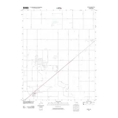
2010 Map of Optima
USGS Topo · Published 2010About this map
Optima serves as the primary center of activity in this 2010 topographic survey of the Oklahoma Panhandle, where the residential grid meets the primary transportation corridor of U.S. Route 54. The landscape is defined by a rigorous section-line road network, including arterial routes like Co Hwy 7 and Co Hwy 19, which segment the terrain into precise agricultural blocks. Curving through this geometric layout is Pony Creek, providing the only natural drainage and topographic variation in an area dominated by commercial and rural development. The map details the transition from the settled streets of Optima to the vast surrounding plains, defined by numbered section roads such as Mile 38 Rd and Mile 43 Rd. This edition reflects the contemporary infrastructure of Texas County, documenting the exact layout of modern rural thoroughfares and land-use patterns just north of the Optima Lake area.
Find a feature on this map
30 named features on this map. Tap any name to fly to it.
Don’t see what you’re looking for? This feature index may not catch every label — zoom into the map to look around manually.
Map Details
Editions of this 2010 Optima Map
This is the sole edition of this map. No revisions or reprints were ever made.
Other maps of this area

1954 · Perryton
USGS Topo · 1:250,000

1958 · Perryton
USGS Topo · 1:250,000

1967 · Straight
USGS Topo · 1:24,000

1967 · Straight NE
USGS Topo · 1:24,000

1967 · Straight SW
USGS Topo · 1:24,000

1967 · Optima
USGS Topo · 1:24,000

1967 · Hooker
USGS Topo · 1:24,000

1967 · Hooker NW
USGS Topo · 1:24,000

1968 · Optima Dam
USGS Topo · 1:24,000

1968 · Guymon
USGS Topo · 1:24,000