
1967 Map of Straight SW
USGS Topo · Published 1968About this map
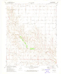
Pony Creek meanders through the northern plains of the Oklahoma Panhandle, carving a shallow valley across a landscape defined by mid-century energy development. The small settlement of Straight sits near the northern boundary, supported by local infrastructure including a Radio Tower and a Landing Field. To the east, the community of Mouser anchors a section of Texas County where the high plains begin to break toward the drainage of Goff Creek in the south. The extensive network of Gas Well and Oil Well sites, connected by a prominent Pipeline, illustrates the intensity of the region's petroleum industry during the late 1960s. Terrain labels like Friendship, Optima, and Guymon indicate the broader regional districts, while localized extraction is evidenced by several Gravel Pits and a Caliche Pit scattered across the township lines.
Find a feature on this map
20 named features on this map. Tap any name to fly to it.
Don’t see what you’re looking for? This feature index may not catch every label — zoom into the map to look around manually.
Map Details
Editions of this 1967 Straight SW Map
This is the sole edition of this map. No revisions or reprints were ever made.
Other maps of this area

1954 · Perryton
USGS Topo · 1:250,000

1958 · Perryton
USGS Topo · 1:250,000

1967 · Straight
USGS Topo · 1:24,000

1967 · Straight NE
USGS Topo · 1:24,000

1967 · Optima
USGS Topo · 1:24,000

1968 · Guymon
USGS Topo · 1:24,000

1968 · Guymon NE
USGS Topo · 1:24,000

1973 · Hough NE
USGS Topo · 1:24,000

1973 · Goodwell NE
USGS Topo · 1:24,000
1973 · Hough
USGS Topo · 1:24,000