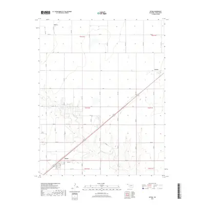
2018 Map of Optima
USGS Topo · Published 2018About this map
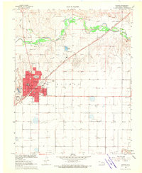
Optima serves as a focal point in this portion of Texas County, situated along the diagonal path of the regional highway and railroad corridor. The landscape is characterized by the broad, meandering course of Pony Cr and its associated drainage patterns, which break the geometric precision of the section lines and township grids. Small settlements like Midway and Panoma anchor the surrounding rural expanse, connected by an extensive network of range and township roads such as Co Hwy 7 and Mile 39 Rd. The layout of Optima reveals a concentrated street grid featuring Indiana St, illustrating the concentrated development at this crossroads. This survey provides a clear look at the infrastructure supporting the agricultural and transport-based economy of the Oklahoma Panhandle, where long, straight road segments like Co Rd 28 stretch across the high plains to link isolated farmsteads and communities.
Find a feature on this map
45 named features on this map. Tap any name to fly to it.
Don’t see what you’re looking for? This feature index may not catch every label — zoom into the map to look around manually.
Map Details
Editions of this 2018 Optima Map
This is the sole edition of this map. No revisions or reprints were ever made.
Other maps of this area

1954 · Perryton
USGS Topo · 1:250,000

1958 · Perryton
USGS Topo · 1:250,000
1967 · Straight
USGS Topo · 1:24,000
1967 · Straight NE
USGS Topo · 1:24,000
1967 · Straight SW
USGS Topo · 1:24,000
1967 · Optima
USGS Topo · 1:24,000
1967 · Hooker
USGS Topo · 1:24,000
1967 · Hooker NW
USGS Topo · 1:24,000
1968 · Optima Dam
USGS Topo · 1:24,000
1968 · Guymon
USGS Topo · 1:24,000