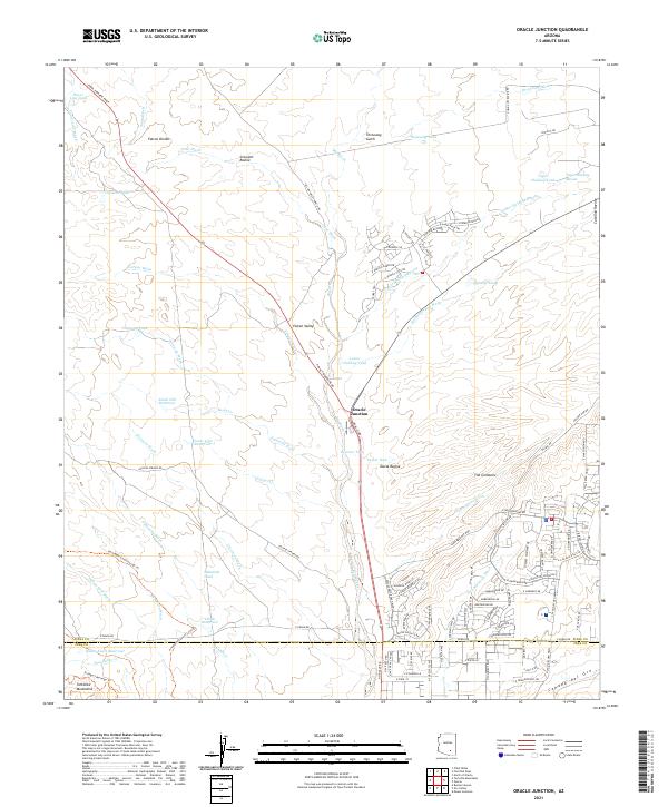
2021 Map of Oracle Junction
USGS Topo · Published 2021About this map
Oracle Junction serves as a focal point in this landscape where desert washes and modern residential development meet. The terrain is defined by an intricate network of drainage features like Big Wash and Cruz Wash, which flow around the Falcon Divide and toward the northern edges of the Tortolita Mountains. The map reveals a transition in land use, from the sparsely settled areas of Falcon Valley to the more structured suburban layouts of The Cordones and the Saddlebrooke area.
Find a feature on this map
110 named features on this map. Tap any name to fly to it.
Don’t see what you’re looking for? This feature index may not catch every label — zoom into the map to look around manually.
Map Details
Editions of this 2021 Oracle Junction Map
This is the sole edition of this map. No revisions or reprints were ever made.
Other maps of this area

1904 · Tucson
USGS Topo · 1:125,000

1905 · Tucson
USGS Topo · 1:125,000

1911 · Winkelman
USGS Topo · 1:125,000

1913 · Winkelman
USGS Topo · 1:125,000

1934 · Tucson Mountains
USGS Topo · 1:125,000

1934 · Newman Peak
USGS Topo · 1:125,000

1947 · Cortaro
USGS Topo · 1:62,500

1956 · Tucson
USGS Topo · 1:250,000

1957 · Cortaro
USGS Topo · 1:62,500
1957 · Mount Lemmon
USGS Topo · 1:62,500