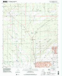
1996 Map of Oracle Junction
USGS Topo · Published 2002About this map
Oracle Junction serves as the focal point of this high-desert landscape at the boundary of Pinal and Pima counties. The terrain is defined by the Falcon Divide and the northern reaches of the Tortolita Mountains, where a complex network of seasonal drainages like Suizo Wash and Batamote Wash channel water through the arid basin. The settlement at Catalina shows established residential patterns in the south, while the northern sections remain dominated by infrastructure and water management features such as the Lower Holding Tank, Pumping Station, and numerous cattle tanks like Tascal Tank. Evidence of industrial and recreational activity appears throughout the quadrangle, including a Mine Shaft west of Copper Creek and the curiously named Rainbows End road, indicating the transition from traditional ranching and resource extraction to modern suburban expansion in the late 20th century.
Find a feature on this map
47 named features on this map. Tap any name to fly to it.
Don’t see what you’re looking for? This feature index may not catch every label — zoom into the map to look around manually.
Map Details
Editions of this 1996 Oracle Junction Map
This is the sole edition of this map. No revisions or reprints were ever made.
Other maps of this area

1904 · Tucson
USGS Topo · 1:125,000

1905 · Tucson
USGS Topo · 1:125,000

1911 · Winkelman
USGS Topo · 1:125,000

1913 · Winkelman
USGS Topo · 1:125,000

1934 · Tucson Mountains
USGS Topo · 1:125,000

1934 · Newman Peak
USGS Topo · 1:125,000

1947 · Cortaro
USGS Topo · 1:62,500

1956 · Tucson
USGS Topo · 1:250,000

1957 · Cortaro
USGS Topo · 1:62,500
1957 · Mount Lemmon
USGS Topo · 1:62,500