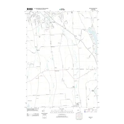
2013 Map of Oran
USGS Topo · Published 2013About this map
Oran and Pompey Center anchor this segment of Central New York, where the upland landscape is carved by dramatic glaciated ravines known locally as gulfs. From Hatch Gulf in the west to Cheese Factory Gulf further south, these steep-walled features influence the rural road network and drainage patterns of the Limestone Cr and its western branch. The area maintains a strong agricultural character, evidenced by numerous named holdings such as Tre-G Farms and Temperance Hill Farms. Genealogists will find a high density of small burial grounds, including the Southwell Cem and Pease Cem, which preserve early family and community names. The topography transitions toward Cazenovia Lake on the eastern edge, while the southern boundary is marked by the community of Delphi Falls and the cascading waters of Pratts Falls.
Find a feature on this map
138 named features on this map. Tap any name to fly to it.
Don’t see what you’re looking for? This feature index may not catch every label — zoom into the map to look around manually.
Map Details
Editions of this 2013 Oran Map
This is the sole edition of this map. No revisions or reprints were ever made.
Other maps of this area

1895 · Chittenango
USGS Topo · 1:62,500

1895 · Syracuse
USGS Topo · 1:62,500

1897 · Cazenovia
USGS Topo · 1:62,500

1898 · Syracuse
USGS Topo · 1:62,500

1898 · Chittenango
USGS Topo · 1:62,500

1899 · Cazenovia
USGS Topo · 1:62,500

1900 · Tully
USGS Topo · 1:62,500

1902 · Chittenango
USGS Topo · 1:62,500

1938 · Syracuse East
USGS Topo · 1:24,000

1942 · Oran
USGS Topo · 1:24,000