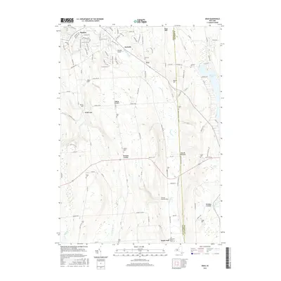
2016 Map of Oran
USGS Topo · Published 2016About this map
Limestone Creek and its various branches carve through the landscape of southeastern Onondaga County, defining the settlement patterns of this central New York region. The area is characterized by a series of deep ravines and waterfalls, including Edwards Falls, Brickyard Falls, and Pratts Falls, which have historically influenced local topography. The map detail highlights small rural clusters such as Oran, Watervale, and Pompey Center, each connected by a network of county roads and historic farm routes. Genealogists will find a significant concentration of burial grounds, from the Delphi Falls Baptist Church Cem in the south to the Southwell Cem near the western edge of Cazenovia Lake. The terrain is marked by distinctive local features like Peck Hill and the appropriately named Cheese Factory Gulf, reflecting the area's agricultural and industrial heritage. This survey provides a clear view of the rural-suburban interface near Manlius as it stood in the mid-2010s.
Find a feature on this map
117 named features on this map. Tap any name to fly to it.
Don’t see what you’re looking for? This feature index may not catch every label — zoom into the map to look around manually.
Map Details
Editions of this 2016 Oran Map
This is the sole edition of this map. No revisions or reprints were ever made.
Other maps of this area

1895 · Chittenango
USGS Topo · 1:62,500

1895 · Syracuse
USGS Topo · 1:62,500

1897 · Cazenovia
USGS Topo · 1:62,500

1898 · Syracuse
USGS Topo · 1:62,500

1898 · Chittenango
USGS Topo · 1:62,500

1899 · Cazenovia
USGS Topo · 1:62,500

1900 · Tully
USGS Topo · 1:62,500

1902 · Chittenango
USGS Topo · 1:62,500

1938 · Syracuse East
USGS Topo · 1:24,000

1942 · Oran
USGS Topo · 1:24,000