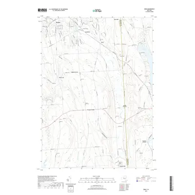
2019 Map of Oran
USGS Topo · Published 2019About this map
Manlius and the surrounding rural uplands of the Onondaga Co and Madison Co border define this landscape in the late 2010s. The terrain is marked by deep glacial incisions such as Hatch Gulf and Cheese Factory Gulf, which create a dramatic relief between high points like Peck Hill and the winding course of Limestone Creek. This map captures a mix of historic settlement patterns and modern residential expansion, where legacy locations like Pompey Center and Watervale sit amidst a network of newer drives and lanes. Genealogists will find a wealth of local data in the numerous burial grounds documented here, including Oran Cem, Baker Cem, and the Blocktown Cem. To the east, the shoreline of Cazenovia Lake and the village of Delphi Falls mark the edges of a region long defined by its waterfalls and agricultural roots.
Find a feature on this map
128 named features on this map. Tap any name to fly to it.
Don’t see what you’re looking for? This feature index may not catch every label — zoom into the map to look around manually.
Map Details
Editions of this 2019 Oran Map
This is the sole edition of this map. No revisions or reprints were ever made.
Other maps of this area

1895 · Chittenango
USGS Topo · 1:62,500

1895 · Syracuse
USGS Topo · 1:62,500

1897 · Cazenovia
USGS Topo · 1:62,500

1898 · Syracuse
USGS Topo · 1:62,500

1898 · Chittenango
USGS Topo · 1:62,500

1899 · Cazenovia
USGS Topo · 1:62,500

1900 · Tully
USGS Topo · 1:62,500

1902 · Chittenango
USGS Topo · 1:62,500

1938 · Syracuse East
USGS Topo · 1:24,000

1942 · Oran
USGS Topo · 1:24,000