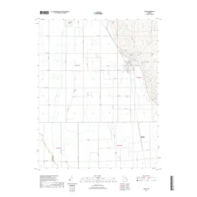
2017 Map of Oran
USGS Topo · Published 2017About this map
Oran serves as the primary hub of this Scott County landscape, where the town's grid is defined by streets like Radcliff St and Missouri Ave. The area is characterized by a high density of rural burial grounds, including Guardian Angel Cem and the Friends Cem, which suggest a long-established community history. The terrain transitions from the developed center of Oran to the managed waterways of the south and west, where the Little River and Caney Creek flow through a network of section lines and county roads.
Find a feature on this map
65 named features on this map. Tap any name to fly to it.
Don’t see what you’re looking for? This feature index may not catch every label — zoom into the map to look around manually.
Map Details
Editions of this 2017 Oran Map
This is the sole edition of this map. No revisions or reprints were ever made.
Other maps of this area

1931 · Sikeston
USGS Topo · 1:62,500

1934 · Morley
USGS Topo · 1:62,500

1934 · Bloomfield
USGS Topo · 1:62,500

1934 · Sikeston
USGS Topo · 1:62,500

1934 · Advance
USGS Topo · 1:62,500

1939 · Bloomfield
USGS Topo · 1:62,500

1939 · Sikeston
USGS Topo · 1:62,500

1939 · Morley
USGS Topo · 1:62,500

1939 · Advance
USGS Topo · 1:62,500

1949 · Paducah
USGS Topo · 1:250,000