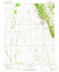
1963 Map of Oran
USGS Topo · Published 1964About this map
Oran sits at a geographic transition point where the high ground of the Moreland ridge meets the low, ditch-drained agricultural lands of the Missouri Bootheel. The town serves as a critical junction for the ST Louis - San Francisco and Missouri Pacific railroads, which parallel the ridge line. This mid-century survey captures a landscape defined by significant drainage engineering, with the Whitewater River and East Channel flowing through a network of spoil banks and basins, such as Old Caney Basin. Local genealogy is well-documented through numerous family and community landmarks, including the Guardian Angel Cem, Warfield Cem, and several rural congregations like New Home Ch and Hooe Ch. To the south, the settlement at Brooks Junction marks another rail intersection, while the terrain names Sylvania, Pike, and Morley reflect the early township organization of Scott Co and Stoddard Co.
Find a feature on this map
24 named features on this map. Tap any name to fly to it.
Don’t see what you’re looking for? This feature index may not catch every label — zoom into the map to look around manually.
Map Details
Editions of this 1963 Oran Map
This is the sole edition of this map. No revisions or reprints were ever made.
Other maps of this area

1931 · Sikeston
USGS Topo · 1:62,500

1934 · Morley
USGS Topo · 1:62,500

1934 · Bloomfield
USGS Topo · 1:62,500

1934 · Sikeston
USGS Topo · 1:62,500

1934 · Advance
USGS Topo · 1:62,500

1939 · Bloomfield
USGS Topo · 1:62,500

1939 · Sikeston
USGS Topo · 1:62,500

1939 · Morley
USGS Topo · 1:62,500

1939 · Advance
USGS Topo · 1:62,500

1949 · Paducah
USGS Topo · 1:250,000